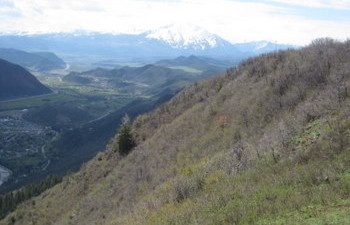
Hiking Glenwood Springs Red Mountain

By Deb Stanley, Examiner.com
Red Mountain is the original location of the Glenwood Springs ski area. Now it’s a place where hikers, walkers and bikers like to work out and enjoy the views. The trailhead is in town, so it’s an easy trek for residents. But the trailhead can be tricky to find, making it tough for visitors. (Directions below)
In the parking lot, signs tell visitors that Jeanne Golay trained on this trail in 1992 when she won three gold medals at the National Road Cycling Championships and took sixth in the cycling road race at the Olympics in Barcelona. The Red Mountain Trail was renamed after Golay to honor her cycling accomplishments.
Now you can hike the same trail Golay still rides. After reading the signs, head west up the trail. When you come to a road, you have options. Take the road uphill to the summit. Or stay on the dirt path which will take you up a steep hill.
No matter which option you chose, you will get to choose again. The hiking trail and the road reconnect several times. When the trail dead ends on the road, turn uphill and take the road until you find the next trail sign. Then choose again, you can take the single track dirt trail or stay on the road. Either way, the trek from the parking lot to the lookout where the paragliders launch is about 3.1 miles each way.
Along the road, you will come to a 180-degree turn with a bench in two places. The benches are great spots to enjoy the scenery. Look east into the canyon to see the Colorado River as it snakes its way to Glenwood Springs. Look north to see the Roaring Fork River where it comes from Aspen, until it merges with the Colorado River. Also to the north is the dramatic snow-capped twin peaks of Mount Sopris at 12,965 feet.
At the top of the mountain, you’ll find a lighted cross, a paraglider launch zone with wind socks and an old home of some sort. Enjoy the views and return via the road and/or the trails.
Details: While many articles say the trail is 1-2 miles each way, my GPS registered 3.1 miles to the paraglider launch spot. A sign at the trailhead said the trail was 3.5 miles. Expect at least 1,600 feet of elevation gain.
Directions: From the bridge over the Colorado River, go south, then turn west on 8th. Go one block and turn right to get to 7th Street. Turn left on 7th Street. Turn left on Midland, right on 10th, right on Red Mountain and left on 9th to get to the trailhead.
If you want to do more hiking in Glenwood Springs, try the Hanging Lake, Storm King Mountain, Grizzly Creek, Dotsero Crater or Doc Holliday’s grave. For an extensive list of hikes in Colorado and throughout the west, click here.
Don’t miss any of my hiking reports. Follow me, HikingDebbie on Twitter or DenverHikingExaminer on Facebook.
